Deep Learning-Based High Resolution Field Level Soil Moisture Mapper from UAVs
Intelligent irrigation systems help solve this by applying the right amount of water in the right place at the right time. The first step in building such a system is creating a high-resolution map of soil moisture across a field.
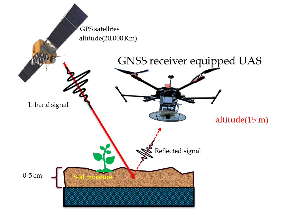
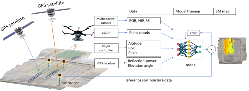
This project aims to develop a cost-effective, field-level soil moisture mapping system using data collected from drones (UAVs). Our approach combines satellite signals (GNSS-R), multispectral camera images, LIDAR point clouds, and other sensors. By analyzing radio frequency (RF) signals from satellites, we can measure soil moisture at a depth of about 5 cm, even through vegetation.
Since many factors influence GNSS-R data—such as plant cover, soil texture, terrain, and satellite positions—we use machine learning to improve accuracy. Over four years, we gathered extensive data from UAVs equipped with various sensors over cotton and corn fields under different farming practices. Our goal is to provide farmers with high-resolution, easy-to-use soil moisture maps to improve irrigation efficiency and support sustainable agriculture.