
Visualization Techniques Improving Public Understanding of Severe Storms
July 28, 2008 One of many projects sponsored by the Northern Gulf Institute at the GeoResources Institute is Dr. Robert Moorhead's project which deals with Visualization Techniques for Improving Public Understanding of Severe Storms. For states along the Gulf of Mexico this naturally brings hurricanes to mind.
The objectives of this project are to develop a hardware/software system which allows analysts with access to many large data sources to see those datasets in the viewing "environment". This capability enables them to extract the maximum amount of information and then knowledge from the datasets and study the optimal method to display various sets of multiple co-located datasets (topography, bathymetry, coastline, oceanography, and atmosphere) in the same view volume. This project focuses on developing new 2D and 3D visualization tools for people ranging from hurricane experts to the general public.
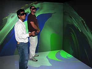
In these photos, Jamie Dyer, PhD, from MSU's Geosciences Department meets with NGI researchers and graduate students in the VERTEX facility to see visualizations of Hurricanes Lili and Isabel. He shared his expertise as a climatologist/meteorologist who concentrates his interests in climate dynamics and hydrometeorology. Interaction and collaboration among campus-wide departments is enhancing NGI severe storm research at Mississippi State University.
For more information, please contact Dr. Robert Moorhead.